Click here to head to the first update.
2025-1-16 — New Year, new timetable
After having not worked on the map for a hot while, a new timetable for 2025 dropped. This meant some route changes, but nothing major.
2024-6-24 — Woensel
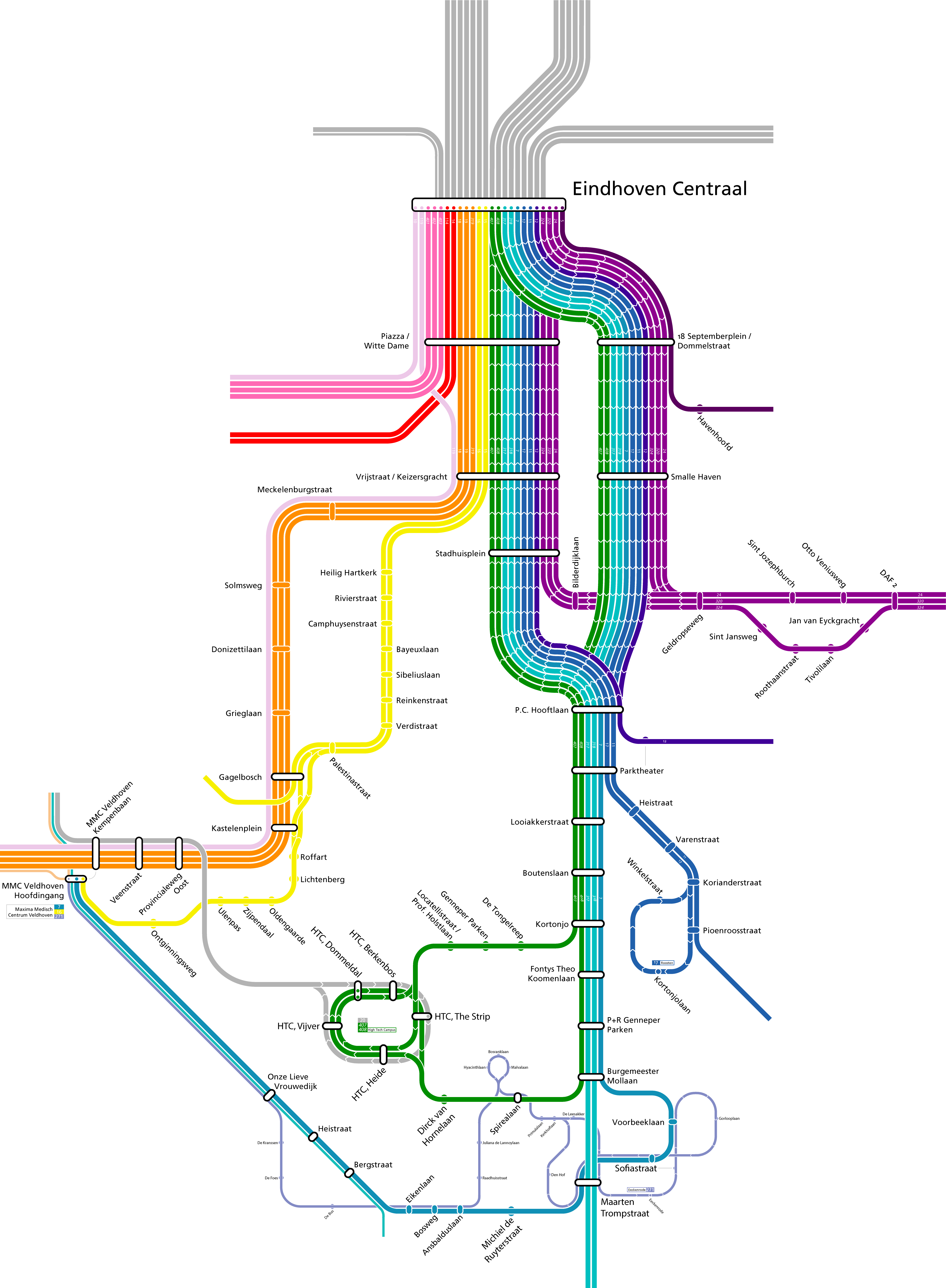
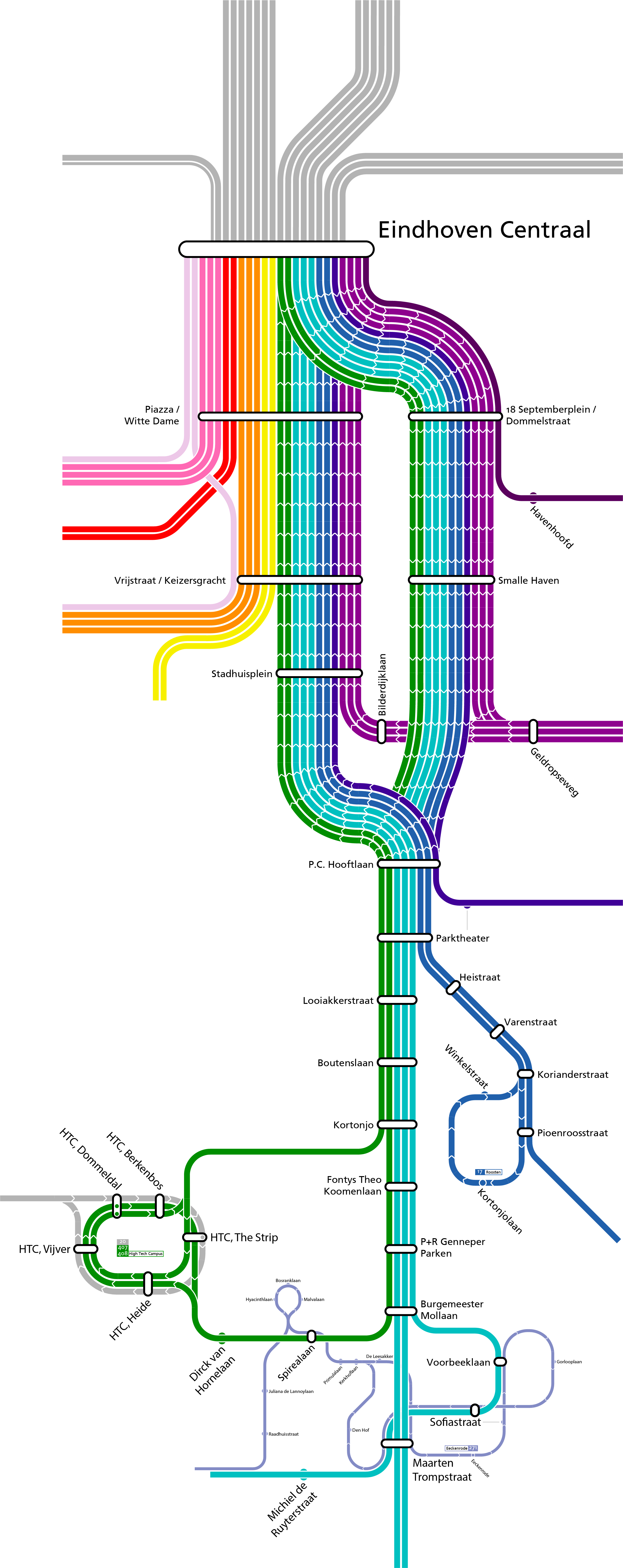
I’ve continued in the southwest and finished some lines there. More importantly many of the lines going north from CS have been added to the map. I haven’t been able to decide on how to colour them, but progress is certainly being made.
2024-5-27 — Kempen
I’ve continued drawing in the Kempen region. This update includes multiple local busses as well as adding line numbering in places.
2024-5-18 — Three Hovens
This update focusses around HOV1 (pink bundle) connecting Eindhoven Centraal to Veldhoven and Meerhoven. Making everything fit, especially line 14 and 114, required some creativity.
2024-5-13 — To the West
This update saw the map getting extended along the southwestern BRT corridor HOV4 (orange bundle) - headed towards the MMC Veldhoven Hospital and the ASML campus. Figuring out the routing surrounding Kastelenplein and the Hospital bus station were the challenges here.
2024-5-7 — Slight Expansion and Colour Change
The colours of the map have gotten overhaul to improve the readability of the map and better show line bunders. It also makes the map prettier. Furthermore, stops in the Town of Aalst have been added. Buurtbus 271 was particularly challenging to figure out how to map, that line is such a mess :’).
2024-5-5 — Starting out
First step in the process was making the base design for lines and stops, which turned out as follows:
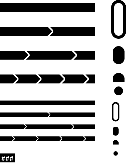
The top assets are used for regular and BRT lines. The smaller assets are used for local (buurtbus) and school lines.
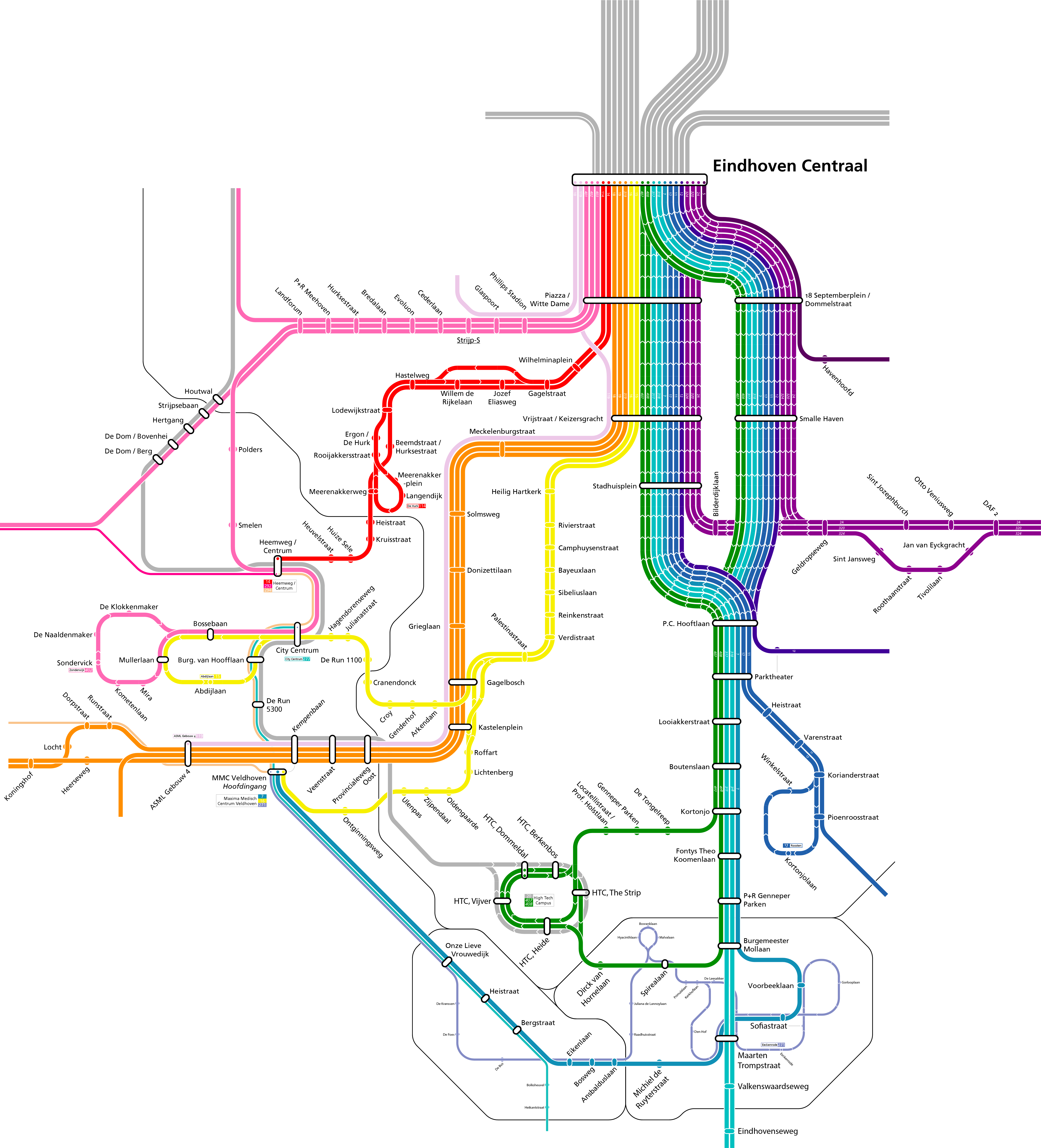
Then, using the official network map, OpenStreetMap and the OVNL-Wiki as sources, I begun drawing the schematic map from scratch, starting with Eindhoven Centraal and the city centre.